Weather Integration
FlightFigures can load and analyze real-time aviation weather data using METAR and TAF reports.
This weather data can then be used directly in Take-Off and Landing Performance calculations to improve accuracy and situational awareness.
Overview
Weather integration is available from the Meteorological Conditions section in:
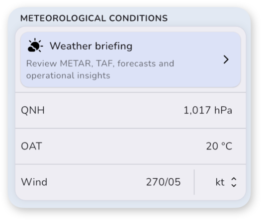
Tap the Weather briefing button to display the weather briefing view for the selected airfield.
When the view opens, weather will be fetched automatically. Depending on weather availability, two situations are possible:
- Weather data is available for the selected airfield
- No weather data is available for the selected airfield
Weather Available
When weather data is available, FlightFigures displays:
- the raw METAR
- the raw TAF
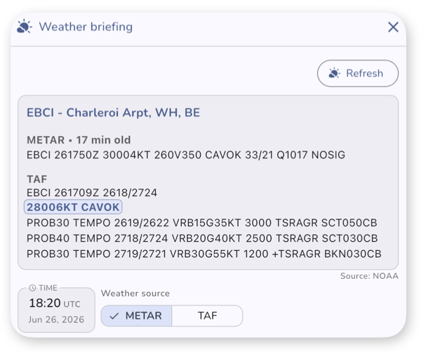
You can then:
- select a Time, representing your Estimated Take-Off Time or Estimated Time of Arrival depending on the context
- choose the Weather source:
- METAR
- TAF
If a time is selected, the relevant forecast segments are automatically highlighted in the raw TAF.
Expected Conditions & Operational Insights
Once a time and a weather source has been selected, you will see an analysis of the weather.
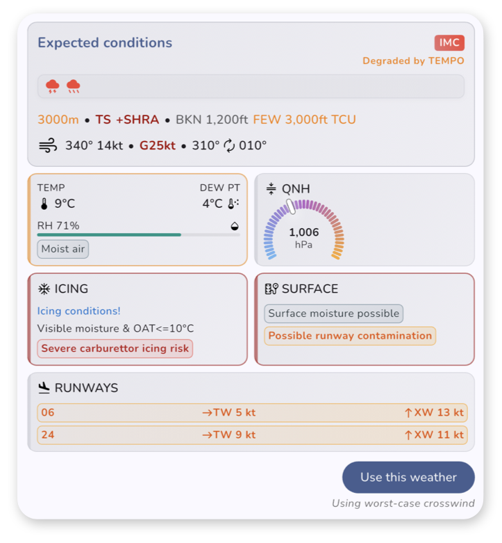
The Expected Conditions section summarizes the weather conditions expected at the selected time using the selected weather source.
The section may display:
- Flight rules status
- Weather phenomena
- Visibility
- Cloud coverage
- Wind conditions
Below you will find a serie of additional weather insights from an operational point of view.
Flight Rules
The displayed flight rules depend on the settings configured in the app.
Supported systems include:
- Jeppesen Flight Rules: VFR, MVFR, IFR and LIFR categories based on visibility and ceiling thresholds defined by Jeppesen
- ICAO Flight Rules: VMC/IMC classification based on ICAO criteria (visibility < 5,000 m or ceiling < 1,500 ft)
Temporary Weather Degradation
A warning such as Degraded by TEMPO may appear when the expected conditions are affected by temporary forecast deterioration.
This may occur with:
- TEMPO
- PROB TEMPO
forecast groups in the TAF or METAR trends.
Weather Insights
Additional weather insights may be displayed depending on available data and airplane configuration.
Possible insights include:
- Humidity insight
- Relative humidity
- Fog risk and moist air indication
- Pressure insight
- QNH analysis
- Icing insight
- Icing or Freezing conditions
- Airframe icing risk
- Carburetor icing risk (if applicable, depending on the engine of the airplane)
- Surface insight
- Frost possibility
- Possible reduced braking action
- Possible runway contamination
- Surface moisture indications
- Runway insight
- Wind components for available runways
- Crosswind analysis
- Runway selection assistance
- Runway Visual Range for available runways, if specified
Runway Analysis
The runway insight displays wind components for each runway of the airfield.
The following abbreviations are used:
- HW – Headwind
- TW – Tailwind
- XW – Crosswind
If available, Runway Visual Range (RVR) information is also displayed.
You may select a runway directly from this section.
Using Weather for Performance Calculations
Tap Use this weather to automatically apply the selected weather conditions to the performance calculation.
This may automatically update:
- QNH
- OAT
- Wind
- Selected runway
- Runway condition
If a runway is selected from the runway insight, it will also be applied automatically.
No Weather Available
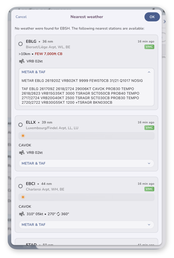
If the selected airfield does not provide weather information, FlightFigures can search for nearby weather stations.
Nearby airfields are searched within a configurable radius defined in the app settings.
The default search radius is 50 NM.
For each nearby airfield, the app displays:
- expected conditions
- flight rules
- wind information
You may also view the raw METAR and TAF for each nearby station.
Important Notes
Weather data limitations
- METAR and TAF data may not always reflect rapidly changing local conditions.
- Forecast weather remains predictive in nature and may evolve.
- Always use official operational weather briefings and approved aviation sources when required.